Sources
Lebanese Ministry of Interior and Municipalities - www.interior.gov.lb
Central Administration of Statistics - www.cas.gov.lb
Ouadi Deir Dourit is located in the kaza of Chouf, an administrative division of the muhafazah of Mont-Liban.
| Muhafazah | Kaza | Distance from Beirut (km) |
|---|---|---|
| Mont-Liban | Chouf | 38 |
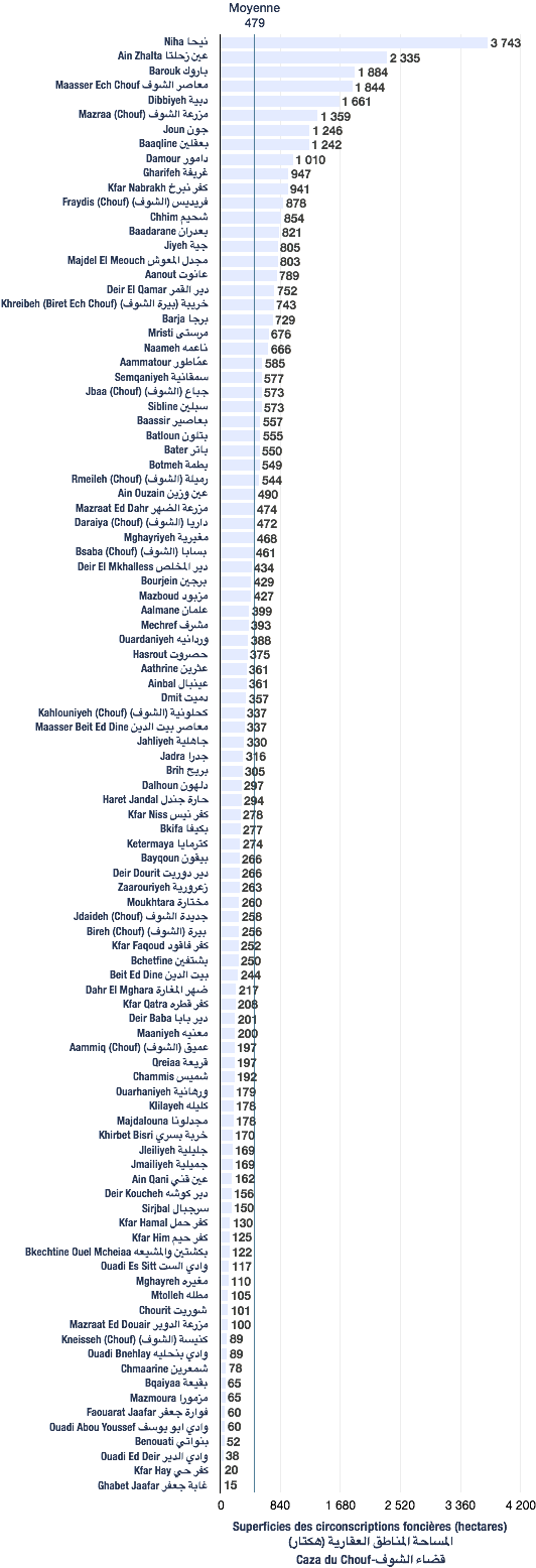
The following data are based from a publication of the Central Administration of Statistics (2005). (non-exhaustive list).
| Registration divisions |
|---|
| Ouadi Deir Dourit |
| Kaza | # of registration divisions | Average (hectares) | Total of areas (hectares) |
|---|---|---|---|
| Chouf | 100 | 479 | 47,904 |
| Village/towns/cities | # of mukhtar·s |
|---|---|
| Ouadi Deir Dourit | 1 |
The following data are taken from the primary voters lists, published by the Ministry of Interior and Municipalities in early 2017
| Voters | Maronites | Melkites |
|---|---|---|
| 214 | 135 | 79 |
| # | Bureau | Circonscription | Quartier | Électeurs | Abstentions | Votants | Blancs & nuls | Exprimés | % participation | % abstention |
|---|---|---|---|---|---|---|---|---|---|---|
| 280 | بيت جاهز قرب منزل المختار انيس راشد | الشوف | وادي دير دوريت | 162 | 76 | 86 | 0 | 86 | 53 | 47 |