Sources
Lebanese Ministry of Interior and Municipalities - www.interior.gov.lb
Central Administration of Statistics - www.cas.gov.lb
Jebla is located in the kaza of Batroun, an administrative division of the muhafazah of Liban-Nord.
| Muhafazah | Kaza | Distance from Beirut (km) |
|---|---|---|
| Liban-Nord | Batroun | 67 |
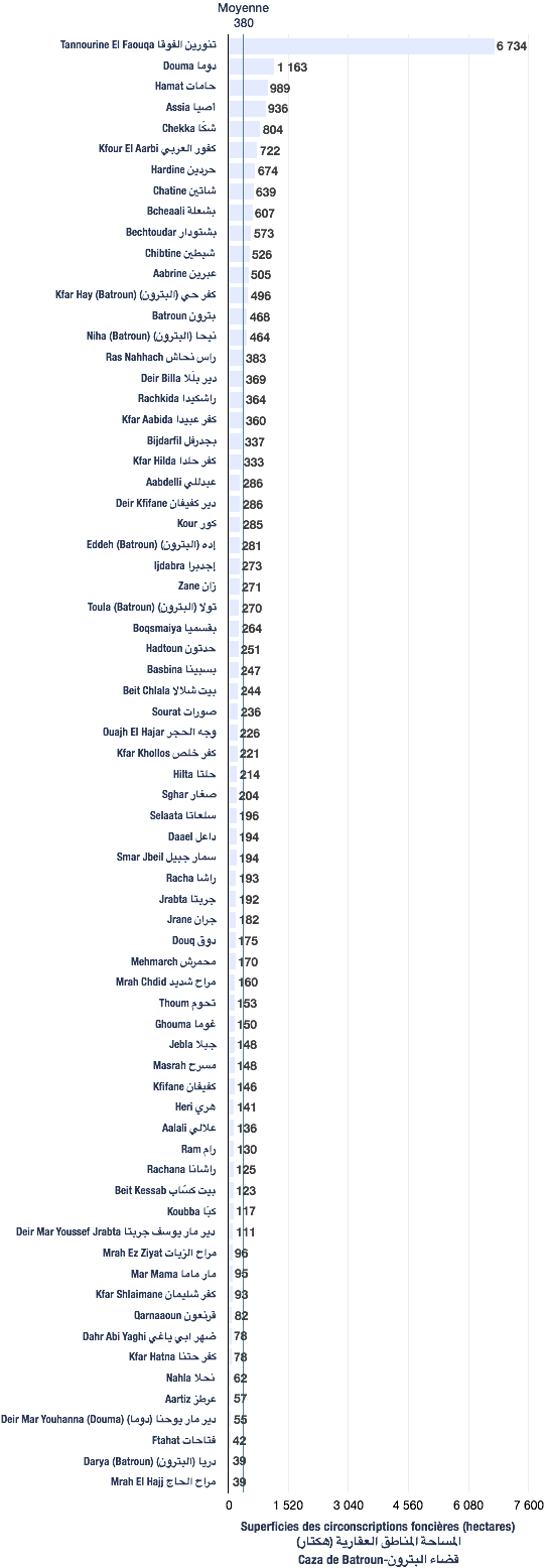
The following data are based from a publication of the Central Administration of Statistics (2005). (non-exhaustive list).
| Registration divisions | Area (hectares) |
|---|---|
| Jebla | 148 |
| Kaza | # of registration divisions | Average (hectares) | Total of areas (hectares) |
|---|---|---|---|
| Batroun | 73 | 382 | 27,885 |
| Village/towns/cities | # of mukhtar·s |
|---|---|
| Jebla | 1 |
The following data are taken from the primary voters lists, published by the Ministry of Interior and Municipalities in early 2017
| Voters | Maronites |
|---|---|
| 277 | 277 |
| # | Bureau | Circonscription | Quartier | Électeurs | Abstentions | Votants | Blancs & nuls | Exprimés | % participation | % abstention |
|---|---|---|---|---|---|---|---|---|---|---|
| 75 | المدرسة الرسمية | البترون | جبلا | 266 | 79 | 187 | 0 | 187 | 70 | 30 |